The Project |
|
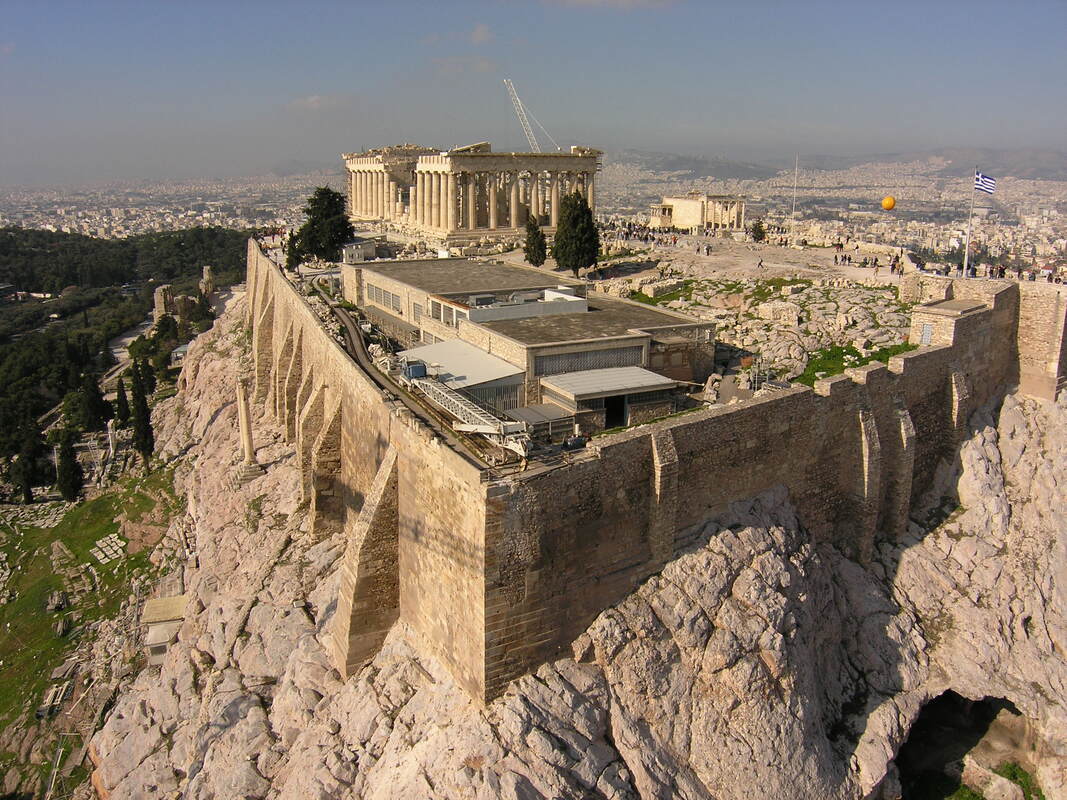
Multi-Temporal Synthetic Aperture Radar (SAR) Interferometry (MT-InSAR) The capability of SAR interferometry to remotely monitor areas much wider than traditional surveying techniques, without the necessity to install in-situ ground instrumentation, makes this technique particularly suitable both for historical sites characterization and single building monitoring. MT-InSAR cannot be used as a real-time monitoring tool due to the current revisiting times of the satellites. However, considering the growing investments of the national and international community, it is reasonable to assume that in the near future there will be systems offering daily acquisitions.
In this proposal the following multitemporal SAR interferometric techniques for the detection of structural and ground motions affecting the archaeological heritage and monuments: a) Persistent Scatterers Interferometry (PSI) approach based on the GAMMA/ Interferometric Point Target Analysis (IPTA) processing scheme customized for monument scale monitoring. b) A heritage-monitoring-oriented Tomography-based Persistent Scatterers Interferometry (Tomo-PSInSAR). This technique integrates merits from PSInSAR and SAR tomography. |
|
|
Identification of georeferenced scatterersΤhe identification of permanent scatterers will be performed with the use of the very high resolution optical imagery, as well as by fusing the highly detailed Digital Surface Model (DSM). It is crucial that this task will be performed by implementing robust and highly reliable processes that will secure the maximum accuracy for the deployed methodology.
|
ValidationThis step would be performed on the deformation estimates by NTUA with the contribution of all partners. HUA and Terra Spatium will contribute by providing and classifying the produced SAR interferometric data at any requested format. Acropolis Restoration Service (YSMA) and Heraklion Antiquities Ephorate will contribute as consultants providing their expert knowledge on the pathology of the monuments.
|
|
|
Risk Assessment
Risk Assessment will be performed by the participation of all partners. It will involve the analysis and risk assessment concerning the structures of each monument and the analysis and risk assessment of the surrounding areas of each heritage site. From the Greek side, YSMA and Heraklion Antiquities Ephorate will provide the necessary information for ranking and zoning the cultural heritage sites and monuments according to their significance, whereas HUA and Terra Spatium will provide essential information about the spatial and temporal characteristics of the observed ground deformations.
|